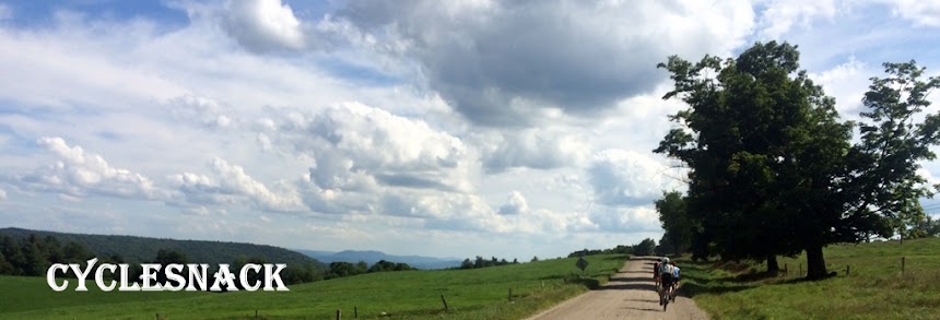
One of the things that I like about where I live is that my gravel/mixed terrain rides can start on a dirt road as close as a quarter of mile away. Today's ride hit First Dirt on Tamarac Road.

The goal of today's ride was to explore Stiles Road that used to connect Southbury to Woodbury. Ride up the Trolley Bed to Tuttle Road and then check out Old East West road that runs through the middle of the Whittemore Sanctuary. Ride the Middlebury Trolley Trail, to Hop Brook Park, get on the portion of the old Railroad bed through there and then take the Larkin Bridle Trail down to OEC Brewing. Lastly ride the top part of Nelson Road.
Four years ago is when I did my first True to Brew ride with True Cyclery, a boutique bike shop in New Haven. It was called the True to Brew Adventure ride and we started from the shop, road various dirt roads until we got to the Larkin Bridle Trail and then road to the OEC and Black Hog breweries where we of course drank beer. From that event I started leading my own rides with a similar twist, only calling them Roubaix to Brew. A mixed terrain ride to a brewery, drink some beer, eat some food (nowadays, its BYOF) and the final key point is to carry some back with you. Since Black Hog is closed on Sundays, that left OEC that was available to visit.


On paper, or if look at the Southbury GIS website, Stiles Road goes through to the town line.

In reality, well, you can still make out where the road went.

On the Woodbury side it turns into Great Hollow Road but there is a Stiles Road that the town doesn't recognize as going through. However, if you look at an old topographic map, it did connect.

Of course, what I found in reality was something quite interesting. There is an old road there but its barely passable. As soon as you pass the last house in Southbury and enter Woodbury there is a big tree down. And then another, and yet another.

Once you are past the downed trees the old road becomes a stream bed

Once you get around the stream bed it does open up for a bit and you can ride it.

During the whole slog through the forest the Climbpro feature on my Garmin Edge said this was a 6 to 9% climb. Not sure how accurate that was.

It kept climbing and through some nasty stuff but you could still make out the edges of the old road

Eventually the ROW became a trail that was so much easier to follow.

I had mapped out the route using Ride with GPS. Eventually the old road happened upon a trail that looked like it saw a lot of traffic. I headed west on the trail, not realizing that was the direction that I was supposed to follow. The trail was actually really nice to ride.

The last quarter mile was really nice although there were a few trees blocking the trail towards the end.


Then it was on to the old Trolley Bed

I have highlighted the route in dark grey

The section where you come out is called Pomperaug and there is a cool dam and an old Mill that at one time the owner was trying to create a mini hydro electric plant but could never get a permit.

Then it was on to the old Trolley Bed

I have highlighted the route in dark grey

I rode over to the old Trolley Bed and started climbing. Halfway through the climb I heard a bell behind me and could only make out a fast apparition in the dark, but something was approaching me quickly. A guy on an electric mountain bike passed me like I was standing still and he was making little effort to pedal. I told him he was cheating and all he said was yes. Hope he wasn't going to ride the Trolley Trails.


There is a wet section on the Trolley Bed but it doesn't bother me because I have fenders. This is also a popular route for Mountain Bikers that want to ride the Woodbury Trolley Mountain Bike Trails. You can park at the brewery, get in a great ride and then drink beer. What a perfect day!

There's also a really muddy section at the bend once you are done climbing. One time while riding through it I got mired to the axels. Now, I just ride up on top of the rock cut to the east of the road bed.

Then I rode the Old East West Road through the Whittemore Preserve and OMG what a road!

My understanding is that the Housatonic Valley Chapter of New England Mountain Bike Association has permission to build some mountain biking trails off of Tuttle Road and I thought they would be accessible from Whittemore but I didn't see anything.

You can just get around the gate off of Tuttle Road

Then you climb but it's easy

There's 4 stream crossing, the first two need armoring and the last two are rideable

The road is in surprisingly better shape from what I can remember from riding through here some 10 or 12 years ago. It's a roller coaster ride all the way through.

After this last intersection you start climbing again and you can see hints of Lake Quassapaug. Coming out onto Route 64 I usually only ride the first section of the Middlebury Trolley Trail because I like to get the most out of the descent after the intersection with Rt 188. Then back onto the trail to avoid the light at the intersection with Rt 63. From there, ride down Rt 63 and turn into Hop Brook State Park.

I ended up riding the wrong way through Hop Brook and wandered around one of the overflow basins until I found a trail but it wasn't the trail that I was looking for.

It was a good trail though and I rode it down to the spillway and then found a trail on the other side.

I went to the top of the dam for the views

And then I made my way back over to Rt 63 and climbed up to the end point of the Larkin Bridle Trail.

The Larkin is a great trail to ride. From Rt 63 to Riggs Street you are climbing 400 feet at an average grade of only 1.3%.

There is one section of the trail where a stream runs right down the middle but no worries if you have fenders! When I popped out on Riggs Street a rider asked if I had a bike pump. I let him borrow my Topeak only to find that it didn't work. I have almost 2,000 miles on this bike, I have never had a flat and thus never used this pump and only now I find out it doesn't work. I gave the guy's tire a blast of CO2 and he was good to go.

OEC Brewery is right by the trail but its separated by a wetland that can't be navigated so you need to take the road to get there.

It turns out that they are the sole distributor of Einbecker Beer in the US. Einbecker is my favorite beer from Germany and now I know where to get it and each bike ride to get beer will be all that more enjoyable.

They also import a lot of other German Beer. Too bad I could only carry 4 pints.

I brought some burritos to eat with my first beer, the first being the Coolship Lager. Not very hoppy, reminded me of a German Pilsner.

The next one I had was the Coolship Lager Americana. The Americana was a little more hoppy that then other one.

I found a quicker way back to the rail trail using North Larkey Road.

Once you get past Rt 188 the trail gets a little grown in

And after crossing the road you a literally riding along side a stream. This is probably the worst section of the trail.

From the Larkin I took a left on Curt Smith Road and took that to Sanford Road, which is a dirt road. Ironically, my ride started out on Sanford Road, which happens to be dirt as well. What a coincidence! Turning onto Jacob Road I finally found the other side of Nelson Road. It's not a bad trail.

The only problem with this route is run into a wall of dirt that leads up to the road portion.

I really had to dig my feet into the dirt to push my bike up.

First time I have seen a horse farting zone

I rode down Bullit Hill and back over to Flood Bridge and Middle Road and then worked my way back to Newtown. I took the bike path along the Rochambeau Bridge and then did the 1/2 mile, 10% climb up Alpine Drive.

Rode the back way through Fairfield Hills and up Old Farm Road to Queen Street and then home!

When I was leaving the house, I told my wife I would be back by 7 PM and it was a little after 7 when I rolled back into Chez Cyclesnack!
No comments:
Post a Comment