Well, I am back in the saddle, so to say. Started riding again about 4 weeks after the crash. I said, when I can pick up my son again, I will start riding again.
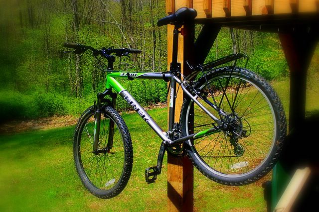
Prior to the crash, I had been somewhat dissatisfied with my new bike. Maybe it was the full suspension that I was not used to, or the weight of the bike ~ 37 lbs, what ever it was it was gnawing on me. Maybe I should have gotten the Kona Hoss. Then, I moved the rear spring to 5.3" setting and OMG! What a difference! I can climb, do rollers, and really hammer. I love my bike.
So, I have done a few local rides in the Paugussett and on the horse trails on the Newtown/Brookfield townline. Finally rode Bennetts Pond in Ridgefield. Also went to Trumbull after Thanksgiving and recently, 12/3, did an almost 8 mile loop around the West Hartford Reservoirs.
What will be interesting is riding in the snow. So, I will post up some more trail maps from my rides here shortly.

Thursday, November 24, 2005
Tuesday, September 27, 2005

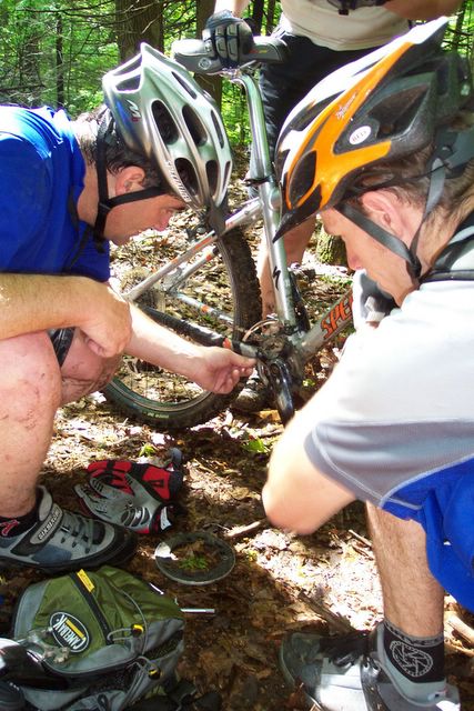
This mornings ride with fellow Bikeragger, Lame Nyer, aka Jim from Danbury. The west side bridal path trail was really nice this morning. However, on the Jeep Trail, Jim's bike shat the bed and he ended up having to break the rear derailuer off. We coasted and schlepped to the top of the ridge and then bombed down the Jeep Trail towards Hanover.

Saturday, September 10, 2005
Pequonnock River Valey - Trumbull, CT

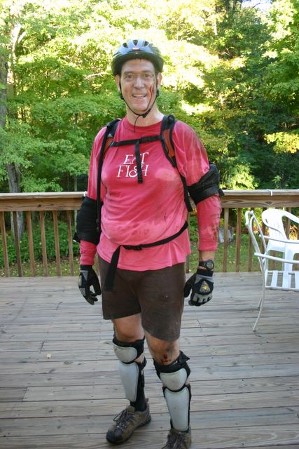
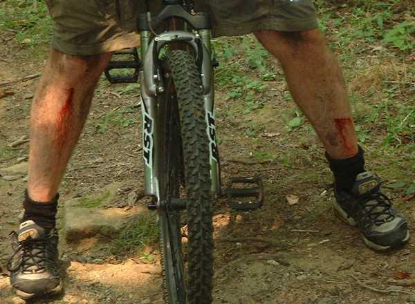
Finally rode Trumbull's Pequonnock River Valley and OMG what a place. There was quite a turn out from the CF crew, too. Quite a ride. Should have been wearing by elbow pads because I fell twice on my left elbow and have a nice couple of scrapes to show for it. Also bashed my peddle again and this time its cracked all the way thru. Lastly, I broke my GPS mount. Where its located is just not good for Freeride. Rode the rest of the way with it in my hydration pack and it wasn't too bad. Tracked pretty well.
Friday, September 02, 2005
Wednesday, August 31, 2005
West Side Equestrian Trail

Found a new trail or atleast a new and improved trail. With all the hoof prints and horse shit on this trail, I would say there equestrian community have decided that the west side of the forest needs a new trail. Its not bad. On the map, its the dark blue trail towards the left of the picture.
Today was the first time riding since I stripped my crank. Class Cycles in Soutbury did a superb job putting new cranks on, fixing my rear axle, and tightening up everything else on my bike that needed it. Basically, they told me that I am riding the bike too hard. Guess, I am going to have to buy a full suspension bike.
So, I decided to ride the west side of the forest. I blasted through the stream bed that I usually go around but since it was dry and the fact that there is tree down blocking trail it looked like this would be easier. Also to note this was my first ride with toe clips and new shoes. I don't think I am ready for clipless and besides I will do that with the new bike, next year.
I noticed that the trail branched off from the blue blaze so I started following it. It detours at one point, goes west and there appears to be other trails, just not marked, so I assumed the way I returned was the right way to go. The trail picks up the blue blaze for another 100 yards but then branches off again. I went left and followed this new trail. I had been down this path before, however, I found that there was yet another branch a little further on that I am not sure was there before. That branch basically makes a bee line for jeep road but before that it crosses the blue blaze once again.
I need to ride this trail in reverse next time. I think it will be more enjoyable. Failed misserably on my first log jump using the clips. Stalled out and couldn't get my foot out of the cage quick enough. Ended up with a nice scrape on my right calf. Subsequent logs were better. Need more practise.
Sunday, August 21, 2005
Stripped Crank, grrrrr!
Either I am riding this bike too hard or I bought a POS! Picked up new peddles yesterday and changing them out was a snap. I made sure that they were both really tight. Even road around my back yard to test them out and did a few logs.
So I out riding today with my daughter, pulling her on the trailerbike and notice that the right peddle is turning funny. I kept thinking that strap was getting in the way (decided it was time to try clips and straps - work my way up to clipless). Got about 2 miles when I stopped to check what was going on and the peddle just fell out! Well it was fun riding home peddling with my left leg and making my daughter do much of the peddling.
Thinking back now, I recall when we went to Ninham last weekend that something on the right side was making a noise when I pushed down on the peddle on that side but I had no clue what it was - now I think I know. I think the peddle threads were already stripped.
Tuesday, August 16, 2005
Thursday, August 04, 2005
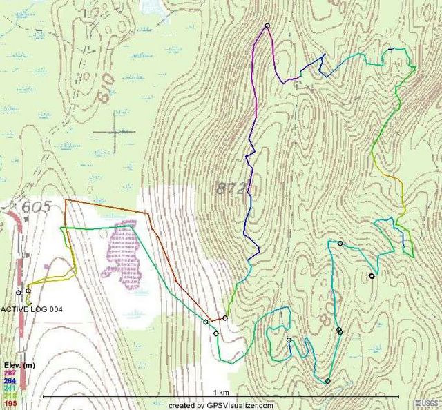
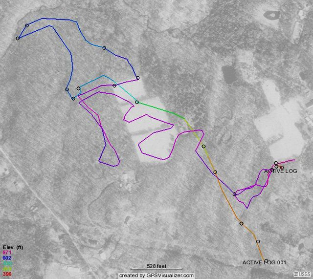
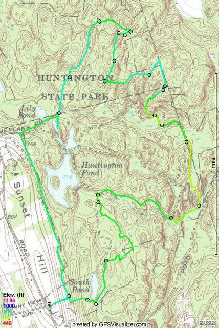
Huntington RAW Single Track
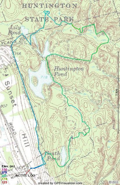
Here is the map of our 8/4 ride with the Nate and Deeman. It was RAW ride, Ride After Work. Also met Hugo03 from Bikerag in the parking lot. First Bikeragger I met in the flesh. The track that is not on dirt roads are single track.
Tuesday, August 02, 2005

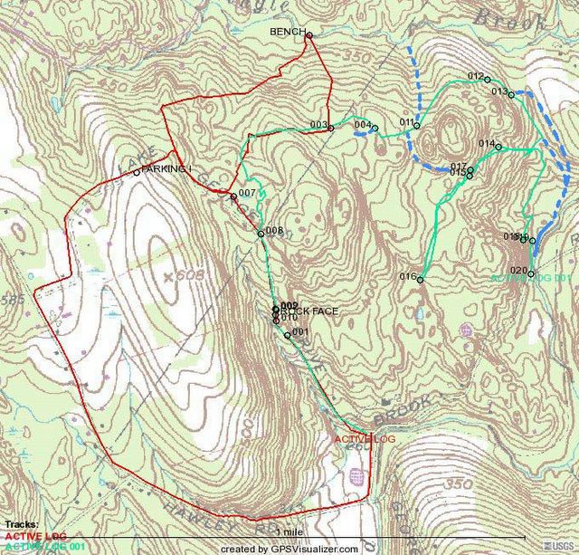
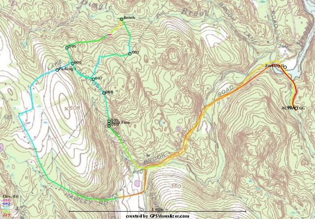
Today's workout in Burr Farm. I haven't seen the bench in a long time so I decided to ride down to it. I also tried it clockwise and it was a much better ride. If you are wondering about the way points: 001 appears to be a better route to take from Lake George to get on the main path (counter clockwise to the bench). 002 is the bench itself. 003 is where there is a ton of Poison Ivy.
Lake Champlain Trailing Biking

Monday, July 04, 2005
Seatpost, Repost
I decided to put my the hitch to my daughter's trailer bike on my seatpost permanently so I wouldn't have to worry about it everytime I rode with her. Went on smoothly and then after some adjustments, seat was in the right spot I tighten down the seatpost clamp.
I tightening it down with a hex wrench and the wrench strips the head! WTF? Well, I decide to let sleeping dogs lie and not touch it.
Rode with Katie today, on the road - boaring! Give me a rail trail or Huntington SP with the trailer bike, but forget the roads.
I tightening it down with a hex wrench and the wrench strips the head! WTF? Well, I decide to let sleeping dogs lie and not touch it.
Rode with Katie today, on the road - boaring! Give me a rail trail or Huntington SP with the trailer bike, but forget the roads.
Friday, July 01, 2005
Seatpost Fiasco
Earlier this week I decided to remedy my seatpost issue with a recommendation that I got from a local MTB forum. The problem is on my rides, the seatpost keeps sliding down. I have tried tigthening and tightening but during every ride, halfway through I feel like I am riding a BMX. So, the recommendation was to cut up a beer can to make a shim, put it in the tube and crank her down. The recommendation was for a Pabst Blue Ribbon can but I only had MGD. Put it in and as I was tightening it down the clamp broke! Cheap POS!
Since I was working from home that day, I figured, OK at lunch I will get a new one. Called around to the various bike shops and they said come on down, we will get you squared away. First one didn't have squat but they sold me a Suntour clamp, circa 1970, to try but I couldn't get it on. Then, I went to two other shops and they had nada.
I called the LBS where I got my ride, after vowing that I would never go back there again - they are MTB unfriendly. Talk about a lack of customer service? I guess that is what you get from a bunch a roadies. Turns out they had something that fit. I brought my bike thinking that since I bought it from them they would fix for me but looked at me like I had plague. I actually had to ask, "Do you think you could put it on for me?"
The counter doode didn't know what to do so he called in one of the mechs who just didn't want to be bothered. Finally, after looking at it and looking at it, figured out what to do and got it on. If you want to know what LBS this is, write me and I will tell you, but I will say they are in Bethel - unfortunately they are the only Trek dealer around. If I get another Trek, it won't be from them.
On my way home I stopped off at some Newtown Forest Association land, Brunot Preserve, that I have been meaning to ride. Nice place that appears to been used for ATV racing and still appears to be abused by ATVs. I would think that if NFA wants to REALLY keep them out, they would do a better job at putting up barriers on the property boundary to keep them out. Only the entrance appears to have been modified.
Its a nice piece of property for Newbie riding but its primarily ATV track riding. Not very challenging. I hope to ride there again to check out the rest of the trails and create a proper map.
Wednesday, June 29, 2005
Dingle Brook Trails

Final Burr Farm, Newtown Forest Association Lands, Open Space Ride map. The little circles are waypoints that mark either interesting features trail junctures or deadends. If you want to download the GPX data, I would recommend going to Crankfire.com where you get can get the individual trails or I think the whole shooting match. Once I get up and running with Bikerag's mapping software, I will have update on that site as well.

Sunday, June 26, 2005
Table Top Paul

Interesting geologic feature on the blue trail, surprisingly not marked on the map. This slab of rock is independent from the one its sitting on and it doesn't wobbel at all. This feature is right in the middle of blue trail as you head down to the old mica mine.
Huntington SP Ride - Blue Trail
Rode six miles today with Paul, a friend of mine from work. It was really, really hot but still a great place to ride for newbies. This place is primarily laden with alot of dual track and if want single track, you have to look for it. When you find it, take it! All sorts of little jumps and obstactles on these little side trips. I will definitely return, in fact, some of the dual track was so flat, I will be bringing my daughter here for a trailer bike ride.
Sunday, June 19, 2005
Father's Day Ride in Sunny Valley Preserve
Finally got over to Bridgewater to ride this place. I have been looking at it online for quite sometime and got the map from the Nature Conservancy but finding the opportunity to go off on my own is increasingly difficult when you have two kids constantly viaing for your attention.
While I studied the terrain it still surprises me every time I ride - these trails basically zig-zag up and down the ridge along Lake Lillinonah. Down hill is fun but the uphill is hike-a-bike city. I saw one other MTB'er as he was finishing his ride other than that, besides a few lost hikers (who overshot their destination) there was no one else to see.
Going from Iron Ore Hill, down, to Rock Hill Road there is a nice stream that can be forded or ridden over on a nice bridge.
The trail continues up along stream but you can also ride the road to the next trail. Apparently its been moved due to logging. Where the trail was, it looks like a grass driveway now. I suppose you could ride that but except for the climbing aspect, it doesn't seem very challenging. Coming back down might be fun but I would rather stick to trails.
Once you get to the top of the next ride, its all downhill from there to Hemlock Hill. Turned around and started to climb. It was gradual enough that I was able to climb most of it.
After passing Rock Hill on the way back, I took the red trail for less gradual climb back to Iron Ore Hill. I was able to ride most of the climbs but there were still a few hike-a-bike opportunities.
All in all, a good work out trail but lacking in flat out riding opportunities.
This doesn't mean I won't go back because there are still additional trails that have to be ridden.
Sunday, June 12, 2005
Larkin State Bridle Trail

The Snack seems to be getting a lot of traffic lately from people looking for info on this trail so as a service to you here are some links you might find useful:
History of the trail
Hand Drawn Map of the trail (from History Page)
Latest Ride with a great map
Crankfire Map
Two tick bites and a dose of Doxycycline
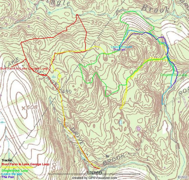
Found a really great trail (green) that follows along the banks of the Dinglebrook, crosses over the main trail that connects Burr Farm to the NFA lands and then winds its way back to the trail (yellow) I found the first time but decided it wasn't going to lead to anything good.
If you want to ride these trails, I would recommend parking at either Pond Brook Boat Ramp located off Hanover Rd in Newtown or the Burr Farm openspace park. If you park at Pond Ramp, take a right when leaving the parking area (onto Hanover Rd) and take the first left, prior to a hill. This is Pond Brook Road. After crossing the brook whence the road's name comes from, the road turns to dirt. Immediately after the next bridge, approximately half a mile down the road you will cross the brook again. On the West side of the bridge, turn right.
Follow the trail as it follows the course of the stream and it will gradually move inland. At the point where the trail turns a sharp right and goes through a stone wall you see two dead trees about 10 feet apart. Proceed straight through, keeping the stone wall on your right and follow the stone wall until you see a big oak tree on the other side of a stream bed (dry now, but wetter in fall and early spring). Other side of the oak tree is the green trail. Best route on this trail is to ride it counter clockwise, unless you like to hike your bike.
If you want to ride the Burr Farm Open Space loop, I would recommend riding it clockwise. The climb from the bench at Dinglebrook on the ride is really gradual.
When I got back to my house after riding I found two ticks attached me. I thought they were deer ticks but I could be mistaken. After removing them, I took them to the town health department where they will get tested for Lyme Disease. The health department gave me a cool frisbee for doing this. Later that day, I went to the doctors office for a dose of Doxycyclene - I am not taking any chances.
Tuesday, June 07, 2005
Burr Farm NFA Ride Work In Progress

I found the trail that connects the old road along the river to the NFA land and town open space! Of course, I didn't see it on the way in, rather the way out. If you zoom in at Waypoint 31, you will see where I added in line that goes to WP 22 which is at the edge of the open field (white on the topo). Not sure where this trail goes but on the map there is house in that direction the field is no longer NFA land.
WP 31 is the intersection that is a connector trail to the main trail. It was covered with Barberry and that is why I missed it on the way in but on the way out, I marked WP 29 where the trail branches and thus connects with the trail out. At WP 12, there is a trail heading off into the woods that may or may not hook up at WP 27. Next time I ride this area I will go that way and see what's up.
I did try to find a connection at from WP 11 that meets up with trail between WP 15 & 16 but got as far as WP 24. There is an animal path but not something that I would want to ride on a regular basis. I think next time I need to go up to WP 4 and see where that goes.
Overall, the Burr Farm is noobie ride, with the exception of the roller in the middle of the ROW (Lake George Rd), these are green trails. However, as far as quick workout goes, they are perfect.
Monday, June 06, 2005
Trailer Bike.
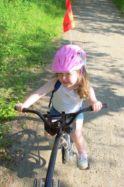
I went out and purchased a trailer bike for Katie this weekend. At first she was scared when we started out but shortly after not only did she get the hang of it, she loved it! I went to EMS and picked up a few biking things, like a handlebar bag for her snacks which she must always have. We used to run on a railtrail in Ridgefield where she would sit in a jogging stroller and I would feed her cookies or crackers and she would sip water for the five mile round trip run.
We parked at Pepper Street and rode down to the bottom of Great Hollow Lake. We turned around about 0.2 miles from Purdy Hill and then rode back. We went past the car at Pepper Street and rode to the end of the trail which abruptly stops at what I think is the townline. The trail continues but its more single track riding and very narrow with over growth. So we headed back to the car. Our next ride will be the Larkin Trail in Southbury.
Thursday, June 02, 2005
Brought home a Christmas Tree!
So, here are the results from this morning's ride. The green track is from today's ride, the red is my initial Burr Farm OS ride, the dashed blue lines trails that may or may not exist (I will explain, later).
As you can see I didn't quite find the loop that I was looking for by the fact that I had to turn around (appoint 16). At WP 15 there appeared to be a trail that may head down to Pond Brook but I wasn't sure. There might also be a trail that hooks back to the main trail, that is why I put the blue dashed line because I don't really remember. What I do remember about this location was trying to up a small stream bank, hitting a rock, and going Endo (over the handle bars). That was fun.
The trail that leaves the red trail at WP 3 is a nice ride, nothing too steep or technical, in fact you can really get going through there. At WP, 4 there is a trail that intersects that was marked with orange engineer tape. At WP 11, there is a trail that branches to the north and heads down hill. Might have to see where that goes on the next ride. At WP 12, there is a nice stand of pines. WP 13 there was trail branching off from here that headed down the hill and looked to go towards the fields (shown on the topo from the previous post). I think this might lead to the trail along Pond Brook.
After turning back from WP 16 I probably should of headed down the hill from WP 15. It really didn't look like a trail but it would have mostlikely brought me to the one that I found after back tracking almost half way back to WP 13. As you can see, I had to bushwhack until I found a trail that took me to Pond Brook.
The next time I ride this, I am going to try it from the trail along Pond Brook and see where it leads. Hopefully it will connect at WP 13 which combined with the rest of the trails will be an excellent additional to my Burr Farm OS Ride Map. These trails are green trails but there are quite a few nearby rollers to venture out on. Combined with a run down to the bench on Dingle Brook and then back up towards the Burr Farm OS Parking lot, will make an excellent workout ride.
More to come...
Finding new trails along the Newtown/Brookfield boarder
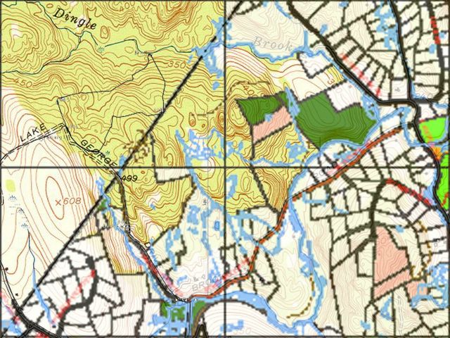
I created this map last night using the 1950's Topo Map from Historic USGS Maps of New England & NY from the Univeristy of New Hampshire and the Town of Newtown Open Space Taskforce Map to see if I could find a connection between my Burr Farm OS trail and the trail that runs north of Pond Brook after the Brook crosses under the road. Newtown Forest Association (NFA) Lands are in dark green and Town Open Space is Pink. Over the townline, you will notice a black lines that represent the Burr Farm OS Ride that I initally mapped. You may also notice that there is some sort of road that is shown that would appear to come from the NFA land towards the center of the map and looks like a stretched out S laying on its back. It would appear that there could be connection from the Burr Farm OS loop to this logging road, into the NFA lands, and then down to Pond Brook trail and spills out to the road. Hence the purpose of this morning's ride.
Find that loop!
Tuesday, May 31, 2005
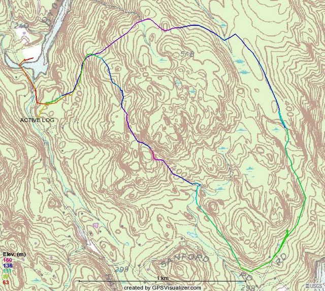
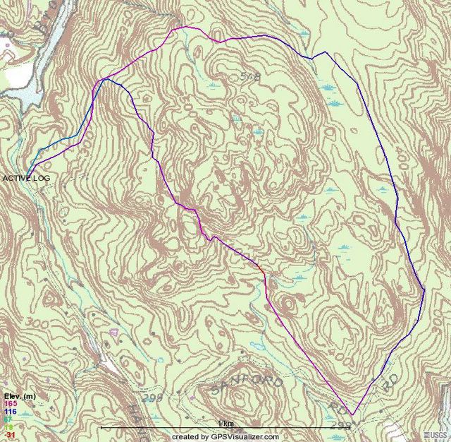
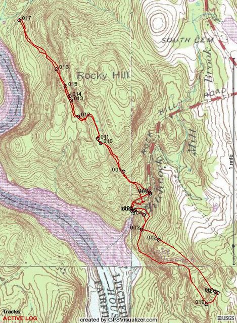
Upper Paugaussett Trail Map

Spent an hour and a half getting throughly confused yesterday in Paugaussett SF. Rode the blue trail from the parking lot (olive green) at the entrance that intersects with an old Jeep trail (Blue & Red) on the eastern boundary. Interesting little ride that consists of two hike-a-bikes (the art of dismounting one's ride and pushing, carrying, schlepping, up a hill that is too steep to climb peddling, or if one is just too tired to do so), one was up a ledge along a little cliff. I felt like Lassie and little Timmie was trying to coax me up to safety.
Between the hike-a-bikes is a beautiful right of way (ROW) from days gone past. Both sides are edged with 4 foot stone walls. Unfortunately, there are too many trees down to make it passable. This ROW is the one that runs from Albert's Hill/Al's Trail intersection up past the house at the start of the SF and into it the woods (SF) proper. It's probably how the farmer(s) moved livestock and wagons into the area for farming. Acording to the maps I have seen, at one point it just stops which makes me think that it was the route to fields.
So, heading down hill I hit the old jeep/logging trail which starts on Sandford Road, so I guess this means it turns into the blue trail. There is a branch off which is marked with blue/pink engineer tape (olive & red), that I rode a couple of weeks ago. This trails appears to be a cut-off from the blue trail that gets around some really nasty climbing (yes, more hike-a-bike). I wonder if this might have been put in by a fellow rider. When I intersected with blue trail again, I went south to see where this goes and found that it climbs to the top of one of the highest points in the SF and then drops sickenly down (hence the by-pass maybe). Picked up the blue/pink again and found that it bypasses this steep climb another way, too. So, is the purpose of the blue/pink just to get around this steep part or what?
So I followed the other blue/pink cut-off back up the hill, picked up the blue, rode past where I the other cut-off intersects with the blue to where the blue turns due west towards the exit of the forest. At that point, there is a trail marked with pink tape that cuts over to the main Jeep trail. There were more blue markers headed into the woods in the direction of the Pond Book Boat ramp and Al's trail but after 100 yards I lost the trail and headed back. I did find a nice camping area with a fire ring. Getting back to the Jeep Trail (green) for the final down hill ride and the ride was done.
The upper part of the blue trail shown on the map above, starting where it breaks off from the olive trail was indeed a trail that lead straight into someone's back yard. I recorded this track on my GPS the first time I rode the eastern side of the state forest. Rather than back track to find the trail I should have been on, I bushwhacked until I found the blue blazed trail which led me down to the jeep trail and out of the forest. Bushwhack riding is challenging.
Also, I have captured part of Al's Trail (tourquoise). Three quarters of the way, where it does a 90 degree turn and heads due south is a white blazed trail that hooks up with another blue trail (engineer tape) that leads to the Jeep Trail.
More trails to come.
Sunday, May 29, 2005
Saturday, May 28, 2005
Middlesex Community College

Rode from Middlesex Community College with the Crankfire Crew today and let me tell you, these guys are some sick riders!
Above is the track of the ride. The waypoints are all the trail intersections with other trails. If you would like to see a more comprehensive map of this location check out this link: Middlesex Community College
I must admit, by the time I marked my first waypoint (001) I was ready for some dual track fireroad. Single Track riding here is brutal. Upon entering the forest you are riding/threading your way through a tangle of Mountain Laurels, open face rock, over many logs and bridges, and through various streams.
While riding in this terrain was a new experience for me I really appreciated the Crew for letting me catch up to them. I learned something very important about mtb in rough terrain: Momentum is key for negotiating difficult terrain - if you are going to slow, you are going down or you are going to walk. I also learned how to log jump and had some successes and quite few stop shorts, which came close bashing my nards on the handlebars.
I also learned that rocks are hard because one of the crew did a face plant on one. Ouch! Fortunately, Amanda, a.k.a. Rocky, didn't get hurt seriously. Just a bloody nose and cut on her cheek.
I am going to have to get some better gear, first on the list is shorts. The sweatshorts I was wearing this morning either kept getting caught up on the bike seat or wedged up my fourth point of contact.
It's cool how you can find a website dedicated to mtb in your local area, hook up with people you have never met and have great time. The webiste I am talking about is called Crankfire, its really a forum for MTB only the moderator has a passion for GPS and when you marry to the two together, you make maps, like the one above.
By the time I arrived back at the parking lot, both legs were bleeding from various cuts and scrapes receive along the way and I was soaked in sweat. Granted, I was wearing a long sleeve T and a short sleeve T underneath. I drained my Camelback and not once took a leak. I think might have dropped a few pounds today!
Friday, May 27, 2005
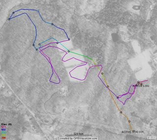
Here is my map of Burr Farm Open Space Ride. I have the start point at Bramble Trail (though not really shown on the map). I used GPS Visualizer to make this map. This is a good ride that can be done in about an hour and provides a great mix of terrain. The trails are mostly single track riding, except for the rights of way (ROW). There is alot of climbing, crossing streams and riding through some really interest property.
You can park at the Burr Farm Open Space Kiosk located at the top of Dinglebrook Road but from Bramble Trail its almost a seven mile ride. Going up Hawley Road is challenging because its an old right of way (ROW). The homeward leg, going down Lake George Rd, another ROW that is impassible to vehicle traffic.
I plan more updates to this map because there are numerous trails coming off of the Open Space Trail (blue blazed) that have yet to be explored. I hope to find a trail that connects the Newtown Forest Association property north of Pond Brook to this area which would make for some really good riding.
This my ride!
This is my ride. There are many like it, but this one is mine.
My ride is my best friend. It is my life. I must master it as I must master my life.
My ride, without me, is useless. Without my ride, I am useless. I must ride my ride true. I must ride better than another rider who is trying to ride better than me. I must ride by him before he rides past me.
My ride and myself know that what counts is not the time spent riding, the time thinking about riding, nor the time dreaming about riding. We know that it is the trails that we ride that count.
My ride is human, even as I, because it is my life. Thus, I will learn it as a brother. I will learn its weaknesses, its strength, its parts, its accessories, its gears and its breaks. I will ever guard it against the ravages of weather and damage as I will ever guard my legs, my arms, my eyes and my heart against damage. I will keep my ride clean and ready. We will become part of each other.
Before God, I swear this creed. My ride and myself are riders of trails. We are the masters of the trail.
Mountain Biking at 40
My father told me life begins at 40 and here I am, 40 years old, a house, a wonderful wife and two beautiful kids, and another on the way. I enjoy what I do for work and I am involved with my town's government by volunteering to perserve open space.
I have seen some of my contemporaries, when they hit 40, go through the proverbial mid-life crisis. They go out and get a fancy sports car to make them feel young again. I don't have the time, nor the cash, for that kind of extravangance. I have two young kids that keep me young.
I still need exercise though and after fifteen years of military service, which comprised of Active Duty, Connecticut Army National Guard, and the United States Army Reserve, Physical Training or PT as it's called, has taken its toll on my knees. Thus, the mountain bike.
Now, take Mountain Biking or "MTB", add a GPS, and what do you have? A new hobby that's good for you. With GPS, I track where I ride in the woods, then come home, download the data to my computer, and voila! I have a topo map of where I have been and where I might go again.
I have found two websites that cater to this, MTB and GPS, in the State of Connecticut. You will find their links on my links payne. The Crankfire Website is hard core riding with a GPS. Bikerag has maps that the webmaster has created and a few others have contributed, as well as myself. Check out my Burr Farm Map on Bikerag. Its also on Crankfire, too.
So, the purpose of my blog is to bring you anything and everything to do with MTB'ing in my life. I will post maps and ride reviews of my own jaunts around the state. I also thought I would separate my MTB endeavors from my other blog, Meine Aufnahmen (My Pictures). There you find pictures of my family and artistic pictures I attempt to take with my digital SLR.
Let's see what happens.
Subscribe to:
Posts (Atom)