Sunday, October 25, 2015

Sunday afternoon spin in glorious fall colors


Hopped on the bike and rode as fast as I could to the Burrito Shack to meet up with Gavin


We rode down to Guskie Pond and then looped back up Hattertown Road


Then up through the Taunton Steps


Past the lake


And up the backside to Castle Hill


The sun was still bright and very warm


We parted ways at the Congregational Church

Sunday, October 18, 2015

Delaware River Roadie


My friend Gavin asked whether I would come with him out to Sullivan County, NY where he has a cottage and that he needed to do a little winterization. Afterwards he offered to take me on a tour of the Delaware River by bike. Having Columbus day off for the first time in probably 20 years, The drive up there was spectacular and eye opening at the same time.  Never have I seen a billboard completely in Hebrew anywhere in the US but there was one on the highway!


Starting just outside of Barryville, we headed South on Rt 97 towards Port Jervis. There was a little climbing that had to be done first and you could just catch a few glimpses of the river. The first five miles of this road is also really crappy.  In fact just out side of Barryville there is a sign that warms you about it. Ride carefully!


After the first big descent, there is the Delaware River, in all it's glory.


Apparently this is a really good river to fly fish but we didn't see anyone fishing.  We did see one group on a raft near Pond Eddy, and there were no other cyclists.  Quite a few people on motorcycles, though!  Just about all the cars passing us gave us a wide berth when passing.


Eventually, we climbed up to a famed section of the of the road called the Hawk's Nest


We stopped for a couple of pictures but continued on towards Port Jervis


Turning around after the descending from the Hawk's Nest we rode back in the other direction.


Took a few selfies over looking the Delaware River


Marveled at this section of the road heading north


Stopped at the old Steel Bridge at Pond Eddy


And then rode back to where we started!


Afterwards we hit the Callicoon Brewing Company for lunch


The Catskill Devil's Path IPA was awesome and I also had the Callicoon Brown Cow Porter, which was great, too!

Friday, October 16, 2015

Cannondale Slate: History Repeats Itself

I finally saw a Cannondale Slate at the Tour de Roxbury and I have to say that it is indeed a fine looking bike.  I didn't have a chance to sit on it or take it for a spin but I wish I had.


This one had SRAM Gearing with an 11:42 cassette and a single chain ring upfront with 42 teeth. With Surly Gnards and that type of gearing, not only is this bike ready for dirt roads but it could also tackle quite a bit of singletrack as well. With the front lockable lefty fork, bombing dirt road descents must be smooth like butter!


This isn't the first time that Cannondale has had cyclocross styled bike with suspension up front. My very own 1999 Cannondale XS800 also had a little squish, too. Funny, how history repeats itself. 

Thursday, October 15, 2015

15th Annual Tour de Roxbury

The Tour de Roxbury is an invitation only, group ride, (and unofficial gravel grinder) that follows bucolic dirt roads in lower Litchfield County. The group/invitees are mostly elite riders from all over the tri-state area with one thing in common, a friendship with Stephen Badger.  


My interest in riding gravel actually started because of the Tour de Roxbury. Back in 2009, Stephen and I started working together on the same team. He invited me to the TdR that fall and while I was just a knuckle dragging, mountain biker and truly nukulturny when it came to this type of riding, after my first TdR, I was hooked.


On my first TdR, I got dropped on the first hill and ended up making my own go of things. In the 6 years since that time, I haven't been able to attend a TdR due to kids birthdays and other family events in October but this time things fell into place and I was able to attend!  Ever since my first TdR, I have been riding the dirt roads of lower Litchfield County regularly.


Six years later, a lot has changed. I have probably ridden over a 1000 miles of dirt roads in lower Litchfield County. I have ridden a variety of bikes that have been propelling me higher and higher in my ability to ride longer and in the past two years, with my conversion to mostly road riding, I have gotten a lot stronger, too.


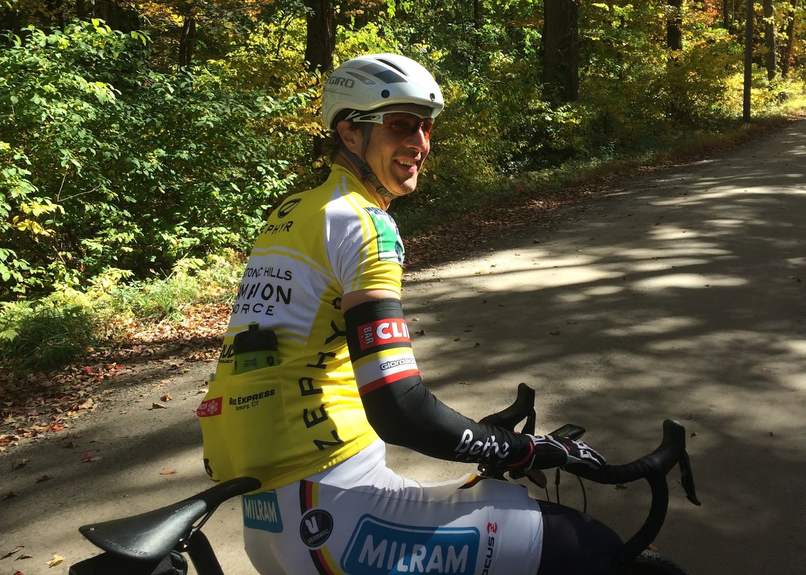
All that said, I probably should still win the biggest Fred award because I showed up to the ride on Sunday, October 11th, without a helmet. Doh! Fortunately, the owner of Class Cycles, Greg Meghani, had a mountain biking helmet I could borrow. The ride started unceremoniously when Badger just started riding out of the parking lot and we were off.   


I felt pretty good after the riding the first hill and not getting dropped but that was the first hill and it was paved. On the first dirt climb I ended up in the back because these guys are great climbers, and they are fast! None-the-less, I was pleased with myself that I was keeping up.


First Dirt on the route was on Old Roxbury Road and it's a steep climb, then it has a great descent and another climb to Bacon Rd. Across Bacon, we climbed up Grassy Hill which is also dirt. Grassy Hill goes through on paper but not for cars and probably only after all the leaves down. I thought I saw a trail but everyone detoured around it.


There was some new dirt on the route that I haven't ridden before but have ridden by some of these roads in the past. The most notable is the climbs up Bear Burrow Rd and Booth Rd. I actually saw people walking on Bear Burrow, which made me feel pretty good because I didn't have to walk. Granted, I might have been moving as fast as they were walking. 


Then it was on to more known dirt roads like Moosehorn and Battleswamp in which I was able to stay middle of the peleton.


Stopping off at Judd's Bridge to regroup was helpful because the first signature climb of the TdR was coming up.


I have climbed Judd's Bridge many times and this time like all the others was no different. It was hard, I took it slow, and I made it, but I was also last.


Then we descended down Hartwell and rode up Walker Brook. If you are going to ride dirt roads in Lower Litchfield County, you have to ride Walker Brook because it's a scenic and gradual dirt road ascent along cow pastures and streams.  I was able to hang with the peleton almost all the way to Route 199. After Walker Brook we swung around over to Hidden Valley but to get there we went down a dirt road called Buffum Road. Another dirt road that I have been eyeing but just never figured out how to work it into a ride.


At Hidden Valley is where we encountered what was billed as Roadie Friendly Singletrack, which in reality was the continuation of the Shepaug Rail Trail through Steep Rock Reservation. There is a 100 yard section of some interesting terrain that unless you were accustomed to riding off road could be a little disconcerting to say the least.  There were a few flats through there that stretched out the group.


The old Shepaug Rail Line, comes out at the Rumsey School in Rumford, CT.


This was a good time to regroup and recharge for what was to come. At the library someone gave me a brownie cupcake, and I ate it here and it was sooooo good!


It was also time to shed some clothes and get ready for the next signature climb of the ride.

Stephen Badger


The route then headed towards Bethlehem and a lot of new dirt roads that I know about but just haven't figured out a good route to connect them yet. We rode Shearer and Dark Entry and eventually to the next big climb of the ride. Calhoun Hill is marked on my Tri-State Gravle Map but like most of the dirt roads that I know about on this side of Washington I still haven't ridden yet. 


There was a pre-ride a few weeks ago that included Calhoun Hill and everyone was in awe of it. I rode it but it was slow and painful!  It starts with a gradual, steep climb of about 8% but then goes to 12% around a corner, then planes out for a couple of yards so you can catch your breath and then you hit a wall with a 15% grade!  The only solace is the wall is paved! 


Then it was cut back towards Washington and the Gunnery School, where we rode up Ferry Bridge, another steep but short dirt road, and then down into Steep Rock Reservation on an old right of way that I have been wanting to ride for quite some time, as well. I missed a turn and followed a more gradual route (dual track trail) into Steep Rock that wasn't on the topo. By this point most people were out of water and there was no water stop, but I planned ahead and had a bottle of Powerade in my frame pack.


Steep Rock was crowded with walkers and it must have been very unsettling to have 30+ cyclists rolling through.  I usually ride halfway down the dirt road and then take the railroad bed straight to the tunnel. We rode to the end of the dirt road and a then took a short singletrack trail to the entrance to the tunnel.  

Photo cred:  Stephen Badger
Riding through the tunnel is something that you have to experience.  You enter it and it's pitch black and then shortly there after, you see the proverbial light at the end of the tunnel and you just glide out the other end.  At the south portal of the tunnel, we took a group photo.


In the interest of time and the fact that the Roxbury Market closed at 3 PM everyone made a bee line back to where the cars were parked. 5 more miles and then it was time for blessed relief and in my case, an ice cold PBR!


What a great ride on such a beautiful day!


Wednesday, October 14, 2015

Fixing corrupt files on the Garmin Edge 800

Beginning in the summer I started having issues with my Garmin Edge 800.  A few tracks were corrupted but I was able to download them using Topo Fusion, so it wasn't a big deal. SportTraks, none of those files would load so I have a big gap there that I am not sure how to fill. 


After my early morning, Oh Dark Thirty Ride Before Work on Friday, I turned off the unit but when I tried connecting to my commuter it would start up and hang on the first screen.  I looked it up on the web found out how to force it into Mass Storage mode, where you hold the power key and the lap/reset button and then let off on the power and it goes into disk drive mode.


Saturday morning I tried the master reset based on what Garmin recommended you do and why:

Here are a few instances in which it may be necessary to perform a master reset on the Edge 800. A master reset should be performed if the Edge is:
  • Not functioning properly
  • Needing to be restored to factory default settings*
  • Not receiving a satellite signal
  • To bring up language selection prompt if incorrect language text is showing
  • Unable to pair up accessories, such as the heart rate monitor or speed/cadence sensor
All settings, workouts, and satellite data will be erased when resetting the GPS. Workouts can be backed up in Garmin Connect. Refer to the FAQ article "How can I backup my personal settings and profiles on my Edge 800?" to back up personalized settings.
To perform the master reset:
  1. Power device off
  2. Press and hold Lap/Reset and Start/Stop
  3. Power device on while still holding both buttons
  4. Continue holding buttons when the Garmin "splash" screen appears
  5. Release buttons when Garmin "splash" screen disappears
The Edge 800 is now reset. Leave the device outside with a clear view of the sky for a minimum of 20 minutes to acquire satellite data.
*A User Data Clear can be performed in order to remove personal settings without removing history.
To perform the User Data Clear:
  1. Power device off
  2. Touch and hold finger in top-left corner of display
  3. Power device on while still maintaining pressure on display
  4. Release display when the Reset device settings to factory default? message appears
  5. Touch Yes
This will erase personal settings, such as the user profile. However, saved activities will not be removed.
Referenced Links:
Of course none of this worked.  After feverishly looking at many different forums I came to the conclusion that I had corrupt files.  On some website, I found some one suggesting doing a CHKDSK /F on the device.  I did that and it started working!
To play it safe, I did a User Data Clear and then reset up the device and works great now!

Not sure what to do if you have a MAC.  


Sunday, October 04, 2015

2015 F2G2: Mo Gravel, Mo Gravel, Mo Gravel!


Two weeks prior to F2G2 there was an urgent message put out by Berkshire Cycling Association looking for more people to sign up and of course I lent my hand in getting the word out, too. It appears to have paid off.  I ran into Brad Herder and he said they were well over the required registrants they needed.  


One thing I noticed between last year and this year is that there seemed to be a lot less mountain bikes and more gravel specific bikes.  Quite a few steel bikes were present.  Wish I had gotten a picture of it but the person parked next to me had a Steel Soma with a single ring in the front sporting a 32 tooth chainring and an 11 speed cassette in the rear, sporting one of those mega 42t cogs!  With that kind of gearing he should have no problem climbing Viets Road!


Will and I started a little before 9 AM and the temperature was around 42 degrees but after 40 minutes of riding, the temperature actually dropped a few degrees.  I am glad that I decided to put on my Lake 303s and wear my cycling gloves with removable overmits because last year I froze.  Better to be too warm than cold. 


From the start I was having issues with my Cadence and Speed sensor.  Two weeks prior, I got a stick in the spokes which bent my hanger and I took the Surly into the shop to get it fixed.  It wasn't until Tuesday of the week before F2G2 that I got it back and didn't have a chance to test things out.  I should have because with the wheel in a new spot, my sensor was all messed up.

Photo Cred:  Brad Herder
Just south of Otis Brad Herder came by and asked if we needed anything.  I asked if he had a small screw driver so I could fix my sensor.  While doing so, he got this wonderful picture of me.  Once I got the sensor arm repositioned it started working correctly and I was much happier.


Further down the road we met up with the Jan from Middletown, CT.  It's kind of ironic in that this was the second gravel grinder in which I meet someone from Germany.  He was checking out all the bikes because he was in the market for a Gravel Grinder bike.  He was more interested in Will's aluminum Cannondale than my steel Surly Cross Check. 

Someone has a sense of humor
Up until this point, the riding was really pleasant.  No killer climbs of the D2R2 caliber, nice dirt roads and very little traffic. Then came Viets Road!  To say this is a road is a huge overstatement but it wasn't a trail, either.  It reminded me of what the Poly Brody Forest Road at Upper Paugussett State Forest would be if it were washed out.  


It was a tough ride to the Smiley Face but even tougher after that.  I made it up a quarter of the way before I had to walk and Will didn't fare any better.  I think a lot of people walked this section.

Photo Cred; Will Mansfield


Dodd Road turns into a jeep trail half way through but it's much more navigable.


Eventually we came to the first Rest Stop at York Lake.  
They had pickles and I was happy!


Some of the Pittsfield High School Track Team cheering us on as we departed the first rest stop.


We stopped off at this eclectic, Berkshire version of Stonehenge off of the Monterey/New Marlboro Road, which looks out towards Connecticut.  We stopped here last year, 


The second rest stop was on Brett Road in Beartown State Forest and it was well stocked!


And of course there were more pickles!


Brett road turns into more dual track and there were two newly built bridges on the trail.
Will is riding over the bigger of the two.


And of course we did the same section as last year in which the Appalachian Trail uses for a bit.  Just like last year there were some really we sections that I just rode through.


Every Gravel Grinder needs a signature climb and on F2G2 its George Cannon Road.

 
Photo Cred:  Will Mansfield

It's the kind of hill that just keeps giving and giving you pain!


The last rest stop was on Goose Pond Road and they were serving pickles!


The last 12 miles felt like it was all up hill.  The climb up Rt 8/20 was hard and then turning onto Jacobs Ladder, there was still more climbing.  At the turn onto Fred Snow, it's down hill to the end!

Another great Gravel Grinder in the books!