My rear derailleur finally died. I think I have to stop riding the game trails in the Upper Paugussett SF because I think that is part of my problem with breaking the rear hanger for the second time. This time I was half way through my ride and had to choose between going back by way of Sanford Road or continue up the back of the hill in the forest and cost down the Polly Brody. I chose the coasting ride.
Took the AC in to the shop and decided to have a Shimano LX rear derailleur put on because its supposed to beefier and more forgiving in the abuse department. Also decided to go with a medium cage in order to get more clearance.
Derailleur works great.

Thursday, May 18, 2006

Monday, May 01, 2006
Tour de Trumbull
GPS Visualizer doesn't seem to be working so no map for right now.
Picked up Mike (Bad Lee Driven from Crankfire) on my way to Trumbull today to run a few errans, drop off Katie with the inlaws, the usual.
Parked off of Whitney Avenue. Ended up riding down the rail trail for a couple of hundred yards before dropping down to the river, crossing over a bridge and then following a trail that paralleled the river. It had blue blazes - does CFPA maintain a trail here? Super techy and gnarly.
Followed this all the way down to the log rides by end of the park. There is a new ride, with a nice ladder up to it. Mike rode it perfectly.
Rode the red/yellow up along the blufs over looking Route 25. Found Ford's Drop, a sick 25 footer in the Indian Caves section.
Rode by the picnic tables. Went over by that nice drop where Meatman had his picture taken doing hi sign off the drop, when we ran into a few dudes, one of which was Tommy Church from Westchester Mountain Biking Association. One guy, busted his seat and I was able to help it out with a few zip ties that I always keep in my pack. Two of the dudes riding with Tommy worked for C'dale and they confirmed the C'dale 29'er is coming soon. Hardtail and a lefty. Hmmmm, gonna have to check this out.
Rode back to Whitney avenue and then headed home. 5.8 mile ride today which capped off the month with 67 total miles!
Yesterday, took the AC in to have the rear deraileur looked at again. I think I need a new one. Shawn at Brookfield Bicycle Center said not only was the cage bent but it was twisted. He did his best to bend it back into shape and today it performed rather well. Still, a new one is my future. Just not sure which. Shawn suggested a Saint and I had read up on these and sound like the way to go with all the bushwacking I am doing.
Picked up Mike (Bad Lee Driven from Crankfire) on my way to Trumbull today to run a few errans, drop off Katie with the inlaws, the usual.
Parked off of Whitney Avenue. Ended up riding down the rail trail for a couple of hundred yards before dropping down to the river, crossing over a bridge and then following a trail that paralleled the river. It had blue blazes - does CFPA maintain a trail here? Super techy and gnarly.
Followed this all the way down to the log rides by end of the park. There is a new ride, with a nice ladder up to it. Mike rode it perfectly.
Rode the red/yellow up along the blufs over looking Route 25. Found Ford's Drop, a sick 25 footer in the Indian Caves section.
Rode by the picnic tables. Went over by that nice drop where Meatman had his picture taken doing hi sign off the drop, when we ran into a few dudes, one of which was Tommy Church from Westchester Mountain Biking Association. One guy, busted his seat and I was able to help it out with a few zip ties that I always keep in my pack. Two of the dudes riding with Tommy worked for C'dale and they confirmed the C'dale 29'er is coming soon. Hardtail and a lefty. Hmmmm, gonna have to check this out.
Rode back to Whitney avenue and then headed home. 5.8 mile ride today which capped off the month with 67 total miles!
Yesterday, took the AC in to have the rear deraileur looked at again. I think I need a new one. Shawn at Brookfield Bicycle Center said not only was the cage bent but it was twisted. He did his best to bend it back into shape and today it performed rather well. Still, a new one is my future. Just not sure which. Shawn suggested a Saint and I had read up on these and sound like the way to go with all the bushwacking I am doing.
Friday, April 28, 2006
Happy Bikeversary!
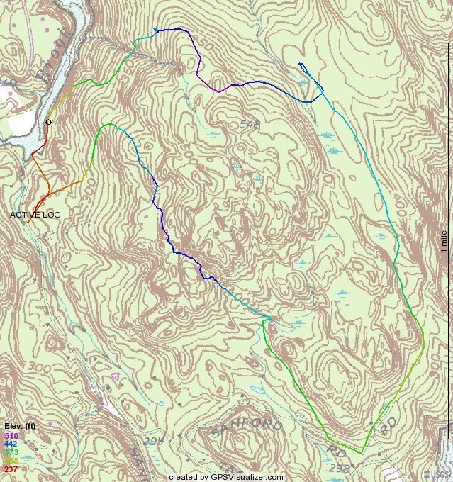 So, here it is. One year later.
Some stats:
1. 316 miles ridden to date and this month I have topped out the most miles I have ridden in a single month, which is 61 miles. Of course, if you subtract the 15 miles from the Cockaponset ride it still works out to be a net increase in riding by 118%!
2. Dropped 15 pounds and consitently keeping my weight around the 200 to 205 mark. Pants fit much better and I gained another hole on the belt!
3. Two and a half bikes. The Trek 3700 was fun and still has a purpose in life - trailer biking and riding with the kids. Once Katie can ride on her own I am getting a rear seat for Elliot. Not sure if I am going to get the kid trailer. I can just imagine Elliot squeezing Brodie's hand too hard, Brodie crying, and me not going any where. The half bike is Katie's trailer bike. And then there is the brute, weighing in at around 37 pounds, the Giant AC. This bike has performed beyond my expectations.
4. Established a presence in the Connecticut Mountain Biking community, with some spillage into Westchester County. Joined NEMBA and am now on the Board of Directors.
So where do we go from here? More miles, more riding, more Cross Stuntry, within reason of course - don't need anymore Boomer-itis statistics for the medical community, and definitely want to start racing. I think I want to get the 29'er for that. That will be my venture into realm of clipless peddles and who knows, maybe I will convert the AC to clipless as time goes on.
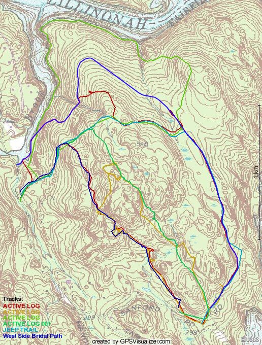
Recap of today's ride in the Upper Paugussett State forest (map above). I decided to follow a notion that the current layout for the Polly Brody Forest Road wouldn't make any sense a hundred or so years ago so I decided to follow the connector on the White trail and found that there is a road, approximately the same width that continues on into the forest heading towards the lake. I followed the trail about 100 yards in to where there were a lot of trees down and it seems to continue on.
Below is my approximation (blue) of where this road would have continued if my theory is correct because where I pick it up on the dropzone leg (red track line), it appears to head into the forest, in the approximate same direction. My guess is that it follows the contours and climbs as little as possible, curves around the hill to meet up with the section near the white trail.
Also re-rode what I called the Equestrian Trail that I rode last fall with Lame NYer and found all sorts of Newtown Open space markers, so the "Yellow" trail which is NBLA's first attempt at a trail through this part of the forest definitely crossed into the Town's openspace property and that is obviously a no-go. Even with the proposed changes that we walked (Cindy and Paula) a couple of weeks ago, the climbing is such that the trail would not lend itself to be a good mountain biking trail. So, it looks like the Multi-use trail that we were planning for the forest might have to take alternative route, especially if we can't get CFPA let us traverse their hallowed ground.
Monday, April 24, 2006
Calm before the storm
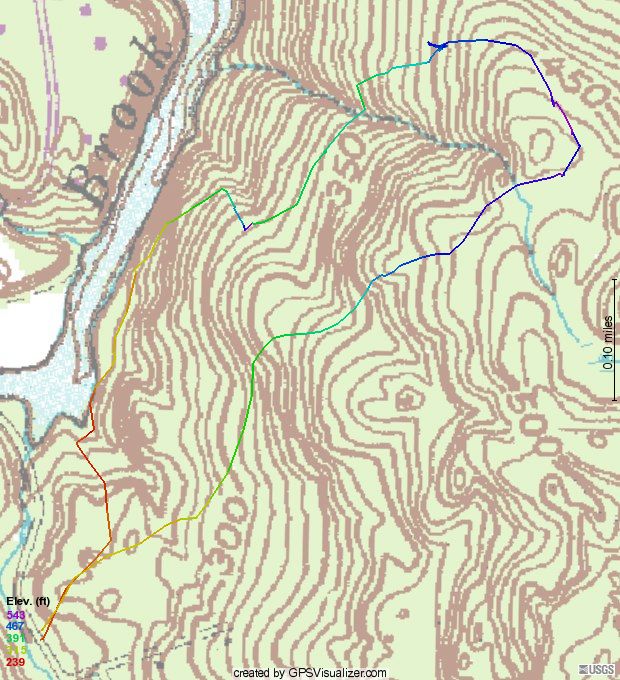 Weatherman said rain all weekend and heavy at times but maybe I heard the forecast wrong because it was certainly wet on Saturday but not that bad. So in the afternoon I went out on what should have been a short jaunt but ended up taking an hour and thirty. Got sidetracked on the Up and Over. I think I got it figured out - logs on the high side make a ramp up and rocks on the low side for the ramp down. Next ride, I am going to give it a show when I have some armor on.
Rather than head down to the Drop Zone, I found where "the road" turns almost due north and heads downhill and then turns west again. Pretty overgrown but doable. After it turns west it becomes a nice trail/road that is rideable both up and down. Still needs a little more work - don't want a branch in the eye.
 One thing I noticed is that where it hits Al's trail, it actually crosses and heads down to the river. I might try to continue through there next time only because I really don't like encountering walkers and hikers on Al's Trail. I think I use most of it still it hits Pond Brook where I think it went to a ford and then cut back up, take a little of Al's trail and then cut out using the Equestrian right of way back up to the Polly Brody.
Here is the aerial. Kind of looks better. What would be nice is if you could get an aerial/topo overlay. It did rain like the Dickens on Sunday though.
Wednesday, April 19, 2006
14 miler in the Cockaponset SF
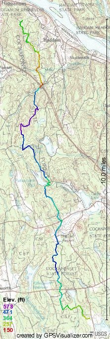 CTNEMBA and the Bridal Path Coalition teamed up today and rode through many of the Cockaponset State Forest Parcels. We met at Seven Eighths Farm
and from here we staged a horse trailer at Exit 8 off of Route 9PX file and you will get a much more detailed view of this Epic Ride.
The ride began at the Webber Woods parcel of the Cockaponset SF, which unfortunately doesn't have an online map but it is a quintessential park that would be great for beginning mountain bikers. I found this description of the parcel on a Mindspeak.org:
Cockaponset State Forest is the second largest state and my vehicle off of Clark Road in Higganum. While the map on the left is a pretty good overview of the ride which I made using GPS Visualizer, check out www.crankfire.com where I uploaded the GPX file.
The forest It is named after an Indian chief who is buried in the Ponset section of Haddam. The DEP acquired the Weber parcel of 354 acres for $780,000 in 1998. Favorite activities include hiking, horseback riding, and mountain biking.
On the first leg of this Epic Ride, Paula, Alex and I started at WeberWoods in Killingworth, CT. Here we are, pictured left. The weather started out funny. It was breezy and partly sunny and it was hard to tell what to start the ride with on. I settled for a t-shirt (which I took off after about 15 minutes) and long sleeve t-shirt. Weber Woods is primarily composed of rode dual track trails that are frequented by equestrians and mountain bikers. In fact, it seems that an organization called Sprock Kids, which is affiliated with NEMBA rides here and periodically does Trail Maintenance with BPC. There were some nice stream crossings and some not so nice because they appeared to be more like intermittentant streams and still muddy from the winter thaw. We met up with the rest of our party, two horseback riders from BPC and proceeded to follow them on what appeared to be seldom ridden trail that took us to State Route 80.
After crossing Route 80, we took another trail/old woodsman road that led eventually to some nice narrow dual track. This trail took us past the Chester Airport, although you couldn't see it, there were quite a few planes either landing or taking off and eventually we came out on Butter Jones Road in Chester. Followed that to Sypher Road which led us to State Route 148. We took a little break at the southern entrance to the Pattaconk Lake portion of the Cockaponset State Forest where I shared my stash of carrots with the horses.
The ride on Filey Road (decaying asphalt) includes a quite a bit of climbing as well as descending but there isn't much challenge because its just a road. Off to the left and right there were numerous trail heads for other trails, including the Cockaponset Trail, which was blazed, I think with a baby or Infantry Blue and a red dot in the middle. Paula mentioned that there was another trail through here called the Pattaconk Trail but I didn't see any special blazes. Hopefully, sometime in the future, this Epic trail will only have to use the hardball just to get into the state forest and then branch off into the woods and pick up one of the non-regulated trails.
We descended upon the Pattaconk lake parking area where we were met by Patty of BPC with snacks and water.
There was a demonstration on jumping rocks both by mountain bikes and horses. I think the horses stole the show. Kristen is jumping the rock with her horse, whose name is Simba.
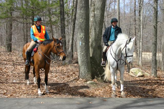

And here is Brad on his Simba. Simba seems to be rage in horse naming.

And after quite a few attempts, maybe it was the size of the rock that proved daunting to Alex, he did finally make a good show of how to do it properl
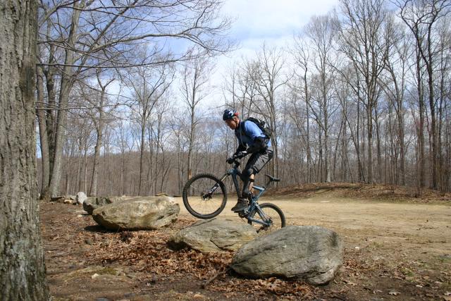
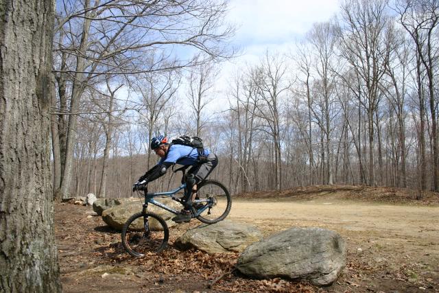 y on a mountain bike.
After a few more snacks we took a group picture,
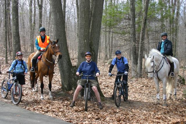
and then got back on the trail. From here more dual track that climbed the ridge that overlooks the Pattaconk Lake and then pretty much planed out for a few miles of easy riding. At one point, we came out onto a dirt road, on the map is called Old Country Road, where we turned due west and the horses took off galloping. After I finished marking the waypoint on GPS for the turn and climbed the hill, the horses were no where to be seen. They are fast! Picked up another trail and actually lost satellite signal for about 20 yards or so.
We followed this trail to Jericho Road, another dirt road in the State Forest, which by this time we were now in the northern section of the forest, as seen as on the DEP's map. It was pretty much down hill from there and the bikes took off first but the horses, not wanting to be left out of all the fun came galloping after us. At one point when I was bombing this one hill I could hear the thunder of hooves gaining on me. I moved as far over on the road as I could and then Brad on Simba (the big white horse from the previous pictures) came barrelling past like a freight train.
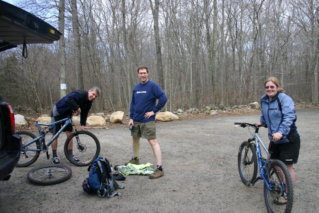
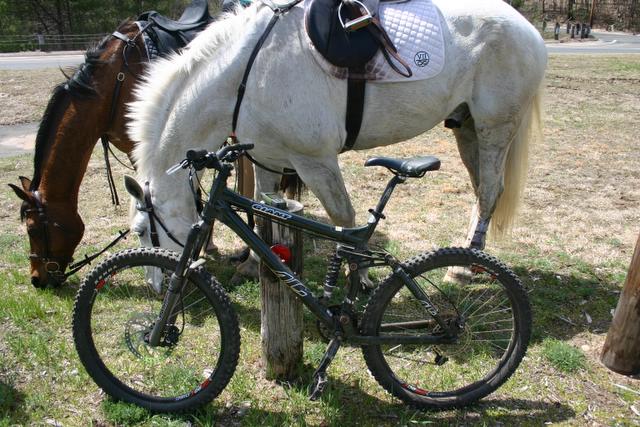
Eventually, we came to the turn off onto the gold trail that would take us down to Beaver Meadow Road and on in to the commuter lot at Exit 8 from State Route 9. There we had some more snacks, Brad and Kristen loaded their horses into the trailer, we took a few more pictures and then Alex, Paula and I pushed on to the last leg of the trip. Here is my AC next to the horses grazing on some fine, State of Connecticut Commuter Parking Lot Grass! What a tasty treat after a long ride!
 I was amazed at how light Alex's
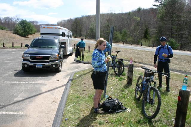 Intense VP 5.5 was. It was a feather in my hands. Paula's new Gary Fisher Cake was even lighter, although it was a small frame. Compared to
  my almost 40 pounds Giant AC. Patty met us there, took a few group shots and I took this beautiful self portait with helmet head. Of course was funny is that after taking that picture, I realized that I had been riding with my shirt on backwards, DOH!

Mounting back up, we road more hard ball to get to the last leg of the trail, which was more dual track, that gave way to an intense double layered hike-a-bike on a trail that was pretty eaten up by Enduro and ATV riding. Trail eventually spit us out onto a cul-de-sac. Another 100 yards of hard ball to next trail head which was the really chewed up by ATVs, super techy, and worst type of trail to be on your last leg of endurance. Finally, we arrived at my car. Of course, what would have been really nice is to have cracked open an ice cold MGD when we got there but I left the cooler by the fridge this morning, DOH! So, we loaded up the bikes and headed bact to 7/8's to recap the ride and have a little a lunch.
Total Odometer on the GPS: 14.9 Miles!
Subscribe to:
Posts (Atom)