
Do you what the best part of starting a ride from a brewery is?
The end of the ride!

I have been waiting all summer for the Norbrook Farm Brewery to open. Last spring, I was updating my Roubaix to Brew map and adding more Connecticut Breweries to it when I saw Norbrook Farms come up in the results. Finally a brewery in the Northwestern part of Connecticut that is just south of some of the best dirt road riding around. Now that the brewery is open, it was time to plan a ride. While it was a little chilly in the morning you could not have asked for a more beautiful day to ride.

I recently discovered some more dirt roads in and around Norfolk so I took this opportunity to try riding them. In particular, I wanted to see if Foley Hill Road in New Marlborough actually went through or not. I have ridden most of the dirt roads in Sheffield, New Marlborough, and Sandisfield but Foley Hill and Rhoads and Bailey were still on my bucket list. Additionally, with this ride I wanted to explore sections of the old Central New England Railroad that went through Norfolk and ride Great Mountain Forest.

I met Shepard, whom I have ridden with a few times this year, and Dean, who rode with me on last week's Autumn Roubaix Classic, at the brewery and we headed towards Norfolk on Stillman Hill. In the sun it felt like the low 50s but out of the sun it was actually 41 degrees. I started out with toe and arm warmers, a wicking shirt under my Jersey, a riding jacket and of course my beer socks. We hit first dirt about a quarter of mile from the brewery on Green Road.

When we were moving, even being in the sun, it was still pretty cold.
The route also included a really nice dirt road descent into Norfolk.

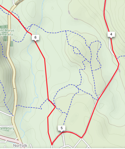
At the intersection with Shepard Road a local man out for a stroll told us where to go to pick up the rail trail.

Turns out it wasn't the railroad bed that we ended up on but some old carriage trails. Eventually we were able to follow the trail back to where I roughly figured out where the railroad bed would be by looking at the satellite pictures. We came out at a series of dykes and dams that I figured were built by the Army Corps of Engineers after the 1958 Hurricane and Flood. While marveling at their handy work and deciding upon which way to go we saw a coyote running across the field.

We found the CNE Right of Way but it was a tough slog because there many wet patches with all the rain we received last week.

I would definitely recommend riding this section when it's a little drier.

Good thing this bridge was here, otherwise we would have been riding around looking for an alternate route

And this other bridge, too

Once on the last dam we recharged, shed some clothing and got our bearings. My route said the railroad bed was straight ahead but I couldn't see it so first we tried following the blazes we saw to the east of our position (see map below on the left) only to find that we were riding more singletrack and since Dean wasn't very enthused about the first bit singletrack we rode and Shepard and I didn't want to subject him to anymore so we turned around.

My preplanned route (map on the right) showed the railroad right of way going exactly where we were but it was too overgrown to see it. Heading the other way, we got closer to North Street and it looked like our option was to ride through a cemetery, when I found a road through the grass that lead to a CT DOT facility and eventually to the road. Once on North Street, I figured out where the grade crossing should have been but there wasn't any sign of the right of way so we kept going and I knew the roads would go around Haystack Mountain where we should find the other section of the road bed.

It was right where I thought it would be only it was gated and there were sings saying Hiking and Skiing, which I thought was kind of weird because the YouTube videos I found talking about this section of the trail showed people riding through there.
The ride up to the Stoney Lonesome cut was pretty good. There were a few downed trees to hop over and some streams to ride through.


And when you get around the bend ...

Surprise, surprise, surprise!

It sure didn't look like what you see in the video on this ride!

With some more blow downs across the trail

After crossing over Locust Hill Road the railroad bed continues as someone's driveway and since it wasn't posted so we headed in. The right of way split off from the driveway but I was unsure whether or not it went through so we headed down to Rt 44 and followed the scripted route which took us to Old Turnpike Road, which by the way parallels the old railroad bed. Post ride and doing a little more searching on the web I came across a description of this area and it would seem that Old Turnpike Road go thru, under the viaduct, according this webpage describing the Central New England Railroad passing through Whiting River.
 .
. 
It doesn't mention, however, how the road got over The Whiting River. There must have been a bridge and my guess that it's long gone. I definitely think I am going to have to come back here for another visit, either by bike or maybe when we get some snow and snowshoe in.

Turning onto College Hill Road we started the first significant climb of the ride with an average 9% grade and a max of 11%.

And then we crossed into Massachusetts at this cow farm.

There's nothing more appealing than the smell of fresh cow manure in the morning

After the cow farm we started climbing again

And kept climbing ...

Until we got to Foley Hill Road

Only to keep climbing, that is until the road ended and it turned into a 4x4 track

And there was a little hike-a-bike, too

Not for Shepard, though

But what goes up must come down and the descent on the other side of Foley Hill was awesome

At the intersection of Rhoads & Bailey and Cagney Road there was a wonderful view of Mt Everett


After climbing to the top of Rhoads and Bailey Road it was all down hill on dirt roads to the CT line and more downhill back down to Rt 44.

Crossing over Rt 44 to Lower Rd we passed this magnificent church and then stopped at the Beckly Furnace

Behind the furnace was a timber crib dam

The slats on the dam create this reverberating sound that is really cool

From the furnace we stayed on Lower Road until we got to Route 7 and then headed into Canaan for water, a restroom, and some lunch the Quikmart/Dunkin Donuts, or is just Dunkin now?

From Canaan we rode down to Housatonic Road, which is a nice flat, dirt road to Falls Village where we found this Caboose on it's own siding next to the main Housatonic Railroad line.

The Caboose was open and while no furniture was inside there was still the old pot belly stove they used to keep warm. Under the observation deck were closets for clothes, an oven for cooking and yes, one of those little closets was even a bathroom.


From Falls Village we continued up Route 126 and then on to Route 63 to eventually turn onto Cobble Road.

Someone had laid down 2 gravel in the flooded area so that cars or trucks could get through on this road but for bikes it was treacherous

I think these steers thought we were crazy

The last and probably biggest climb of the ride was Canaan Mountain Road. A 1.7 mile climb at an average grade of 8%

Then it was into Great Mountain Forest

I have been wanting to ride these dirt roads for a couple of years now ...


The last and probably biggest climb of the ride was Canaan Mountain Road. A 1.7 mile climb at an average grade of 8%

Then it was into Great Mountain Forest

I have been wanting to ride these dirt roads for a couple of years now ...

... and there were awesome.


What makes this place so great is that it's almost like being on a plateau.

Then there is the ride down which was half dirt and half paved

That has to be one of my favorite signs

With more dirt till you got to Rt 272

We rode down Rt 272 till Winchester Road. I couldn't find the entrance to the Billings Trail so we bi passed it. Turns out the trail head was about 1/2 mile down the road on the left.

On the other end the roadbed was quite pronounced.
Now another reason to come back.

The last dirt road of the day was Beckly Road

No comments:
Post a Comment