After 5 years of procrastinating I finally rode the Detour de
Connecticut. Maybe it was a good thing that I waited this long because
in the past it was always held in the spring and from past accounts of
the ride it sounded like it always a miserable day of riding. Saturday's forecast was for 70s and a little overcast clouds which made for perfect riding conditions. You couldn't get better than that for this type of ride.
With the long weekend I was planning on test riding a fat bike and ride all my favorite trails in the area but the forecast for rain dashed those plans, so if I really had one day to ride, it might as well be Saturday and I better make the most of it.
 |
| Salem Mazzawy, Detour de Connecticut event coordinator |
The night before, I loaded up both Garmins, loaded the GPX course to
Google Maps and created cue sheets. I loaded food into my barrel bag,
spare tubes, etc, in the frame pack, and in my trunk bag was first aid
it, another bottle of water, and other essentials. Beside my iPhone, salt pills, and a backup cue sheet I had a can of Salt and Vinegar Pringles.
 |
| Brendon Mahoney |
There were 57 entries on Bikereg but probably 35 people showed up by my estimate.

Salem's father Bob (left in the yellow and pink jersey), was in the group

Someone even brought their son, getting the little ones into the sport early!
 |
| Justin Eichenlaub(r), Detour's Co-Coordinator |
The first 20 miles was on Hop River State Park Trail, which is an old railroad bed that connects Manchester, CT to Wilimantic Connecticut. The route ascends only 300+ feet to Bolton Notch and then descends the same down to the Wilimantic.

A couple of miles in we were cheered on by this girl in a bear suit!

I think she was out supporting the Bolton High School XC team
who were running up and down the trail.

Not that this was a race but suddenly I found myself in a small break away group of 5 riders
 |
| Oh what a relief! |
We got to Wilimantic and me and this other guy really needed a bathroom so he went to nearest Dunkin Donuts however there was just one bathroom and some guy was taking for ever. I had to go so bad I would have been willing to use the lady's room! While waiting the peleton came through and didn't wait for us.

We crossed over the tracks of Providence, Worcester, and Willimantic Railroad and then back under the tracks. Eventually started following trail along the river that was more like a pump track. I got a stick in my spokes and had to stop while the guy I was riding with just kept going although he waited for me at the end of the trail.

The real climbing on the route started on the turn onto Indian Hollow in Windham, CT and that's when the guy I was riding with dropped me. The course in his Garmin was a lot more accurate than mine. My Garmin, throughout the entire ride while tracking the course just said Go Southeast. I had to start using the Cue sheet. I misread the cue sheet and started going the wrong direction. I thought I had turned north too soon and that is when I stopped to check my Google Map of the course and I was a couple of miles off course. The night before I converted the GPX file to a KML file and then created a Google Map from it (shown above) and that was my savior!

I found a route that would take be back to the course. I had a nice climb up Cemetery Road in Scotland, CT and then turned "Southeast" onto Hanover Road. Wow, I live on Hanover Rd, just mine is 80 miles to the west. The reroute and one by pass enabled me to catch up with a group of riders on the ride. Among them was Salem and Justin.

While someone was fixing a flat we hung out and ate on the side of the road

We started riding again and not being a strong climber as all these younger guys found myself with Tim on real old school mountain bike. Tim and I have crossed paths before at various NEMBA events and it was great riding with him. Between Tim's cue sheet on a scroll and my Garmin we easily navigated the route.

Along the way we turned onto a road that was supposed to cut through a farm and then take an old right of way but there was a wedding rehearsal taking place and we were turned back. There were two guys behind us that we told them they couldn't get through but they kept going I guess they didn't believe us.

The climb up Sarah Pearl Road was fun because it went from dirt road,
to logging road and then got steeper

It was 12:15 so we stopped for a bite to eat and I broke out the Pringles

There was a farm before the Airline Trail with water with bananas and oranges. Perfect snack.

Then we hit the Airline Trail back to Wilimantic but it was tough riding because there was fresh marbles all over the roadbed.

Eventually it smoothed out and we were able pick up the pace


Close to Wimilantic the Airline Trail was paved

We rode through Eastern Connecticut State University

And right under the Clock Tower as it struck the hour, it was 2 PM.

Descending down into the central part of Wilimantic the Garmin said there was Dairy Queen on the route

So we stopped for Chilli and Cheese hot dogs!

Then it was back to more rail trail towards East Hampton

The rail trail from Wilimantic climbs a few hundred feet to Hebron

Then descends to the Salmon River

And then climbs again to East Hampton. When Tim and I got there we ran into Brendan and a couple of others. We rode over to the Airline Cyclery Shop for some quick adjustments, bathroom and drinks

Brendan lead the way towards Meshomasic State Forest

There was a little hike-a-bike on Woodchoppers Road

It was dry in the Meshomasic but a great dirt road none-the-less. While descending Mulford Road, my barrel bag wasn't closed and I lost most of the contents that were left, which I think was a few Slim Jims, a Fig Newton, and some Guu Blocks. At the bottom of the hill I stopped to assess what was left, and there was just one Hammer Gel. Fortunately, earlier at the bike shop I had loaded up my back packet with food so I think I had enough for remaining 15 miles.

I caught up to Tim while he was a taking a break and we made our way out of the forest and eventually up to Route 94 on the outskirts of Glastonbury and new we were almost done. I enjoyed my last Fig Newton on the descent down Birch Hill Road.

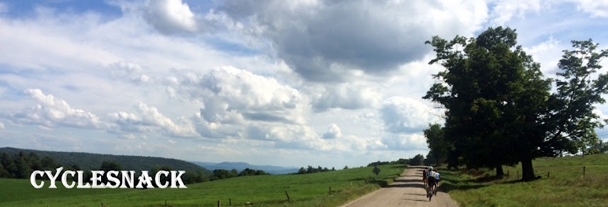
There was a great view from Birch Hill towards the east but didn't have time to get the camera out but then this view of the Connecticut River Valley came into view and it was spectacular.

After crossing under Highway 384 we entered the Porter Reservoir and rode some nice but bumpy dual track to the reservoir.

With just a few miles to go, the sun was getting low in the west and I was eager to get back to the car. A couple of miles out I got the low battery message from my Garmin.

After 120 miles that PBR was the best thing in world!
No comments:
Post a Comment